Books

Books : reviews

Susan Oosthuizen.
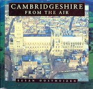
Cambridgeshire from the Air.
Alan Sutton Publishing. 1996

The superb aerial photographs selected for this fascinating book tell the visual story of the Cambridgeshire landscape from prehistoric times to the present day. Human activity and occupation in the area over the course of 6000 years have left indelible marks on the countryside which are clearly visible from the air. Stone Age tracks and earthworks, Iron Age camps and medieval manor houses, modern buildings and sprawling towns with their factories and suburbs, railways and roads can all be seen in this survey with a new clarity and understanding.

The book begins with the traces of the ditches and barrows made by the earliest inhabitants. It then takes the reader through Roman and Saxon times to the Middle Ages and on to the visible remains of the sixteenth and seventeenth centuries. It vividly records the impact of the industrial revolution and the rapid developments of the nineteenth century, and the final chapters show the motorways, housing estates, city centres and golf courses of the twentieth century.

The photographs, which have been chosen from the Cambridge University Collection of Air Photographs, cover the full range of sites that can be found in the county. Famous monuments are included – Ely Cathedral, Cambridge colleges and Wimpole Hall – and so are rare but no less intriguing places like burial mounds and forts, abandoned villages and medieval fields. The book also shows parish churches and village greens, canals and gardens and the orderly patterns of modern suburbs and towns. All the images are accompanied by expert captions which use the results of the latest archaeological and historical research to explain the changing appearance of each place.

Cambridgeshire from the Air will add to the knowledge, appreciation and enjoyment of everyone who takes an interest in the history of Cambridgeshire and in the evolution of the English landscape.

Susan Oosthuizen.
The Anglo-Saxon Fenland.
Windgather Press. 2017

Archaeologies and histories of the fens of eastern England continue to suggest, explicitly or by implication, that the early medieval fenland was dominated by the activities of north-west European colonists in a largely empty landscape. Using existing and new evidence and arguments, this new interdisciplinary history of the Anglo-Saxon fenland offers another interpretation. The fen islands and the silt fens show a degree of occupation unexpected a few decades ago. Dense Romano-British settlement appears to have been followed by consistent early medieval occupation on every island in the peat fens and across the silt fens, despite the impact of climatic change. The inhabitants of the region were organised within territorial groups in a complicated, almost certainly dynamic, hierarchy of subordinate and dominant polities, principalities and kingdoms. Their prosperous livelihoods were based on careful collective control, exploitation and management of the vast natural water-meadows on which their herds of cattle grazed. This was a society whose origins could be found in prehistoric Britain, and which had evolved through the period of Roman control and into the post-imperial decades and centuries that followed. The rich and complex history of the development of the region shows, it is argued, a traditional social order evolving, adapting and innovating in response to changing times.